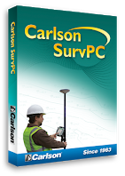
SurvPC by Carlson Software
SurvPC by Carlson Software
SurvPC is a complete data collection software intended for use with the Real Time Kinematic (RTK) GNSS Solution. The software calculates and stores highly accurate in-field coordinate geometry and is backwards compatible with ArcGIS for Desktop. Functionality allows for traditional survey function while performing edits to a geodatabases. For example, feature classes are used when staking. Feature attributes can be queried, edited, and deleted if necessary.
Features
Increased hardware capability
Increased virtual memory & ability to work with large sets of data
Larger screen size & more convenient touch screen usage
More processing & graphic power (with aerial photo overlays)
Save directly to an Esri geodatabase with no import/export
File formats compatible with Carlson office products (.fld, .flc, etc.)
Import of MicroStation .dgn files and Import/Export of AutoCAD .dwg files is possible. Output to Excel for simple data management.
System Requirements
Microsoft Windows NT 4.0 SP6a or later,
Microsoft Windows 2000 SP3 or later,
Microsoft Windows XP for Tablet PC SP2 or later,
Microsoft Windows XP Home & Professional SP1 or later,
Microsoft Windows Vista,
Microsoft Windows 7
Intel Pentium or more powerful processor
64-bit machines are supported, but application itself is 32-bit
256 MB RAM (minimum), 512MB or 1 GB recommended
256 MB of free hard disk space
1 x 9-pin serial RS-232 port optional
Wireless LAN 802.11 b/g/n optional
Integrated Bluetooth v.2.0
Specifications Subject to Change without Advance Notice

