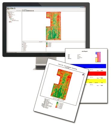
Farm Works View / Mapping
Farm Works View / Mapping
Farm Works View is a free desktop software that allows to easily view precision farming data and recorded data from Farm Works Mobile. View supports all types of data from planting to harvest, providing powerful maps and reports that help make better farm management decisions.
Features
View and print maps with legends.
Build a list of clients, farms, fields, supplies, and other details.
Display and print guidance paths from supported precision farming devices.
Compatible with a wide range of precision farming displays including Trimble, Case IH/New Holland, John Deere, Ag Leader, AGCO, CLAAS, and more.
Easy to Upgrade
View can easily be upgraded to Farm Works Mapping or Surface software without losing any previously entered data. When View is upgraded, new and exciting features will include:
Display aerial background images.
Import and overlay other layers such as soil types and soil test results.
Print a variety of maps and field record reports.
Design basic and advanced prescription maps.
Analyze profit maps to verify which parts of the fields are more profitable.
View/Mapping Install
Download the full install of Farm Works View/Mapping

